Bottomland of the Wakarusa River, near East 1500 Road

View of Coal Creek in Breidenthal Reserve from the top of the Palmyra Ridge near East 1700 Road

Wooly mullein in prairie south of Wolf Creek

Prairie with game trail and wooly mullein south of Wolf Creek

Bottomland underbrush in winter near the Kansas River north of Burcham Park

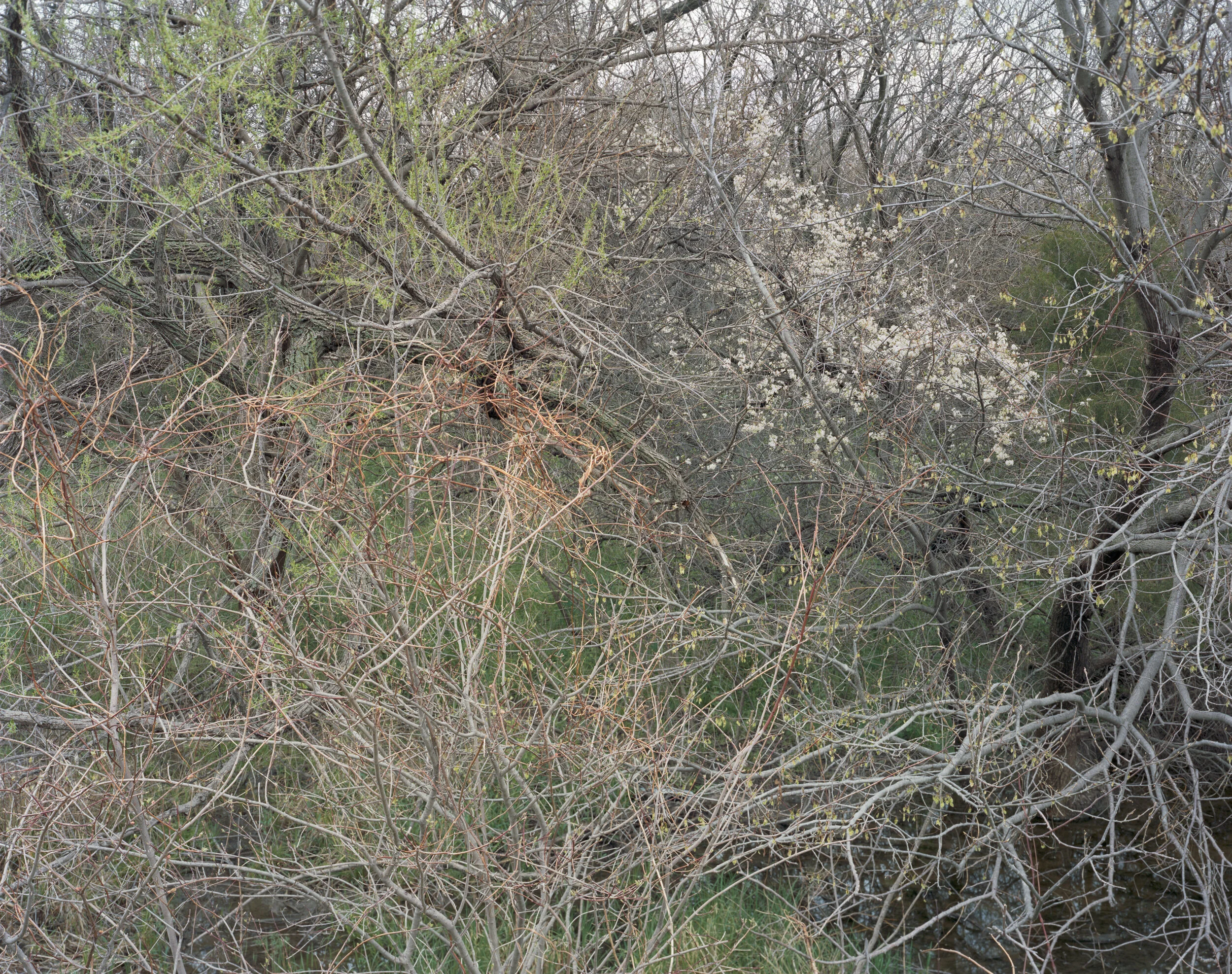
Early spring, Brook Creek

Kudzu near Bonner Springs

Wooded bottomland and brush near the Kansas River west of Topeka
![Heavy frost in riparian brush near Wolf Creek [1]](https://images.squarespace-cdn.com/content/v1/5e866f513076dd384e93f137/1586042224534-GW2G738VXA3I1FBNSY3D/09_Snowmelt_Mist_Wolf_Creek.jpg)
Heavy frost in riparian brush near Wolf Creek [1]
![Heavy frost in riparian brush near Wolf Creek [2]](https://images.squarespace-cdn.com/content/v1/5e866f513076dd384e93f137/1586042225902-Z9SOVJ83GZV5M8CQBLLY/10_Snowmelt_Mist_Wolf_Creek2.jpg)
Heavy frost in riparian brush near Wolf Creek [2]

Heavy riparian brush along Washington Creek

Pasture west of Baldwin City

Cottonwood in pasture west of Baldwin City

Spring at Woodridge

Grasses at Woodridge in winter

West of Ottawa

Near Hesper township

Baker Wetlands along 31st Street
![South of Vinland [1]](https://images.squarespace-cdn.com/content/v1/5e866f513076dd384e93f137/1586042289305-BIC1GX2WADXV4JYU65J8/19_South_of_Vinland1.jpg)
South of Vinland [1]
![South of Vinland [2]](https://images.squarespace-cdn.com/content/v1/5e866f513076dd384e93f137/1586042359909-2H3DKI5IDHMETMHT5ZND/20_South_of_Vinland2.jpg)
South of Vinland [2]
![South of Vinland [3]](https://images.squarespace-cdn.com/content/v1/5e866f513076dd384e93f137/1586042354301-65QH3VPS05H4XATMSKMU/21_South_of_Vinland3.jpg)
South of Vinland [3]
![South of Vinland [4]](https://images.squarespace-cdn.com/content/v1/5e866f513076dd384e93f137/1586042370386-40R233CQ8YOY3NNU9T4L/22_South_of_Vinland4.jpg)
South of Vinland [4]
![South of Vinland [5]](https://images.squarespace-cdn.com/content/v1/5e866f513076dd384e93f137/1586042359814-C3C7GMM9P7ZZ45W3C0NK/23_South_of_Vinland5.jpg)
South of Vinland [5]

Early spring, Kansas River bottomland west of Eudora

Grassland with corral berry near Stilwell

Marsh west of Ottawa

Osage Orange tree at field's edge south of Wolf Creek

Sycamore and riparian woods south of Wolf Creek

Wolf Creek tributary
![Prairie east of Manhattan [1]](https://images.squarespace-cdn.com/content/v1/5e866f513076dd384e93f137/1586042451590-4AOR6DZNNM1NOIH0AZK6/30_Near_Mill_Creek_3.jpg)
Prairie east of Manhattan [1]

South of Tonganoxie

Baldwin Creek near confluence with the Kansas River

Flashflood, Coal Creek
![Wakarusa River at flood stage [1]](https://images.squarespace-cdn.com/content/v1/5e866f513076dd384e93f137/1586042507264-UGEVAPG83ILFJ6FV2WZV/34_Wakarusa_Flood_Stage1.jpg)
Wakarusa River at flood stage [1]
![Wakarusa River at flood stage [2]](https://images.squarespace-cdn.com/content/v1/5e866f513076dd384e93f137/1586042513740-ELLEF0MC8ROW1AS77LLX/35_Wakarusa_Flood_Stage2.jpg)
Wakarusa River at flood stage [2]
![Wakarusa River at flood stage [3]](https://images.squarespace-cdn.com/content/v1/5e866f513076dd384e93f137/1586042499692-62EM1GTUC94ESK8U7CV3/36_Wakarusa_Flood_Stage3.jpg)
Wakarusa River at flood stage [3]

Along Wolf Creek

Riparian brush on the south bank of Wolf Creek

Ice storm aftermath near Vinland

Along Coal Creek

Riparian brush in early spring near Banks Pasture

Roots exposed by erosion along Wolf Creek
Vines and trees north of Hillsdale Reservoir
![Cottonwood and Russian olive trees near the Kansas River west of Topeka [1]](https://images.squarespace-cdn.com/content/v1/5e866f513076dd384e93f137/1586042653852-CGWKTTIF72LGHH2SLGHO/44_Bottomland_Cottonwood1.jpg)
Cottonwood and Russian olive trees near the Kansas River west of Topeka [1]
![Cottonwood and Russian olive trees near the Kansas River west of Topeka [2]](https://images.squarespace-cdn.com/content/v1/5e866f513076dd384e93f137/1586042652436-MYG66FTHKIRUYTCM3VG1/45_Bottomland_Cottonwood2.jpg)
Cottonwood and Russian olive trees near the Kansas River west of Topeka [2]

Riparian woods midsummer near the Kansas River west of Topeka

Russian olive trees near the Kansas River west of Topeka

South of Willard

Prairie and riparian brush near Kill Creek

Cottonwood and grapevine, Kansas River bottomland

Dense riparian growth midsummer east of Lecompton

Dense riparian growth midsummer west of Linwood

Riparian woodland east of Lecompton on the south bank of the Kansas River

Riparian woodland north of Lawrence on the north bank of the Kansas River

Hawthorne and Hackberry north of Wolf Creek after a brief winter squall

Hoarfrost in underbrush near Hesper township

The Baker Wetlands east of East 1500 Road

The Baker Wetlands west of East 1500 Road
![Roadside brush cut back by a brushhog near Sibleyville [1]](https://images.squarespace-cdn.com/content/v1/5e866f513076dd384e93f137/1586042809459-DVRNJ3SY9GDET6WTY9FP/59_Shredded_by_Brush_Hog1.jpg)
Roadside brush cut back by a brushhog near Sibleyville [1]

Cottonwood and black-eyed Susans east of Lawrence

Little Bull Creek and and an unnamed tributary north of Hillsdale Reservoir

The Wakarusa River looking east from the Louisiana Street Bridge

Riparian brush near Hemphill Road north of Linwood
![West of Paola [2]](https://images.squarespace-cdn.com/content/v1/5e866f513076dd384e93f137/1586042893205-YMRRYQ949CNGRLHGEVZZ/64_South_of_56_2.jpg)
West of Paola [2]

Early Spring at Woodridge
Wolf Creek west of Stilwell
![West of Paola [1]](https://images.squarespace-cdn.com/content/v1/5e866f513076dd384e93f137/1586042893120-0N4OO1DGW9GC5KW67EK7/68_West_of_Paola2.jpg)
West of Paola [1]

Near Willard
![Roadside brush cut back by a brushhog near Sibleyville [2]](https://images.squarespace-cdn.com/content/v1/5e866f513076dd384e93f137/1586042972216-LCP7E8ZO5UVF31ZTBJ33/70_Shredded_by_Brush_Hog2.jpg)
Roadside brush cut back by a brushhog near Sibleyville [2]

South of US 56 east of Ottawa
![West of Paola [3]](https://images.squarespace-cdn.com/content/v1/5e866f513076dd384e93f137/1586042979216-O5R2SDKYVXQXS99RU8G4/72_West_of_Paola1.jpg)
West of Paola [3]

Near East 1500 Road west of Louisiana Street

The Kansas River east of Lawrence
unimproved
adjective
1.
not developed to full potential, as resources or the mind.
2.
not showing improvement, as one's health, appearance, etc.
3.
(of land) not fitted for a profitable use, as by clearing, cultivation, addition of facilities for dwelling or business purposes, or the like.
4.
not used to advantage; neglected:
an unimproved opportunity.
5.
(of animal or plant species) not made more useful or attractive by selective breeding or cultivation.
6.
not enhanced; not increased:
Our chance of success is unimproved.
This is a visual study of a fierce will to live. The climate of the Midwestern United States is notorious for its extremes of heat, cold, deluge, drought and howling gales. For any life form to survive here is, in a way, remarkable. Yet life thrives under these conditions, exuberantly.
By the 1830's, land use in the U.S. was conceived as a set of grid squares six miles on a side, covering the entire continent. 180 years later, there exist only pockets of land in this country that are not predominantly shaped by frequent human intervention. This is particularly true of the region around the confluence of the Kansas and Missouri rivers.
Parcels of unimproved land, even though small in scale relative to areas developed for residential, commercial, agricultural or recreational use, offer a striking perspective of the scale and energy inherent in many environmental processes. The vitality, resilience and variety of interacting systems and forms to be found there can be astonishing when scrutinized.
I grew up on the plains of Kansas and eastern Colorado, and moved away as a young man. Returning to the geography of my childhood, that had been dramatically transformed in the 25 years I was away living in dense cities, I found tremendous hope in the incredible vitality of ecological forces at work. This series of photographs is a shift from the work I had been making in urban environments, which was mostly concerned with social matters. The change of focus, from the predominantly human to non-human was startling, euphoric. Outside the action of bulldozers, cement mixers, herbicides, fertilizers, chainsaws, insecticides, mowers and shredders, a timeless cauldron of growth and decay is seething. While exploring these areas, I found myself responding to them as if they had a personality that could be rendered as a portrait. I also observed indications of the crucial interconnections within the environment that make my own life possible.
I hope these photographs will encourage a reconsideration of the life of "unimproved" land, as something worth our affection, wonderment and care. Spending time in these places has given me a deeper sense of faith in the fundamental creative energy of any given ecosystem. It has become much easier for me to see the connections between such systems and our culture. Having gone beyond my concerns for comfort, and my aversion to mud, thorns, burrs, allergen producing plants, ticks and mosquitoes, I have come to treasure the gorgeous bustling proficiency of ecology outside my familiar life within the Cartesian grid of our culture's typical approach to design and land use. This has been a personal experience and is not historically unique. It is, however, a contrast to the prevailing paradigm of regional and global land-use economics and practices. My wish to share what I've seen, through the medium of photography, is founded in the immaterial worth these places have as they have broadened my sense of connection and faith in the tough, exuberant vigor of organic life.
Philip Heying